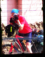


After the bridge I followed the cycle track but I needed to eat so I found a seat. A nice spot except for the early morning dog walkers. Dogs kept taking breaks from sniffing each other's arses to sniff my food. I'd bought a cold "Hot Steak Bridie" the previous evening. I'd asked if it could be eaten cold; it could (but he had looked at me a bit strange), but I think it would have been a lot better hot.
After breakfast I felt short of energy to start with. Even very minor hills seemed a problem. Fortunately breakfast kicked in after a few miles. It was further to Edinburgh centre from here than I’d expected. The signs were inconsistent but probably about 10 miles. The signs again gave the impression of having been put up by two different teams: there were two different sequences with a 3 mile disparity. It was a bit round the houses and it might have been better to take the road in, particular as it was a Sunday morning; the final run-in to the centre was along an old railway track which was pretty good. I did some back doubles looking for a coffee shop and to get my bearings. Tarried a while in Costas and read the Observer.


The mist had lifted a little when I left the coffee shop and I found I was right under the castle, close to Princes Street. I walked along the busy pedestrian precinct where it looked like a tramway was being built. In the coffee shop I had seen from the map that I needed to head out on the A701 or A702/A703 towards Penicuik. I crossed a bridge and then just headed south. For a while I was on Route 1 (and Route 76) but left it when I saw a suitable road heading south. Soon I thought I was on the A701, but it was a few miles before it was confirmed with a sign. I bypassed Penicuik on the B 7026 then joined the A703 to Peebles. The roads were quite busy. The worst bit was an out-of-town shopping area (IKEA etc) where the general driving standards were about as bad as I'd encountered. A lot of very anxious, edgy drivers for some reason. The mist got bad again but lifted soon after Penicuik and it warmed up. Then it was a gentle downhill to Peebles where I stopped for fish and chips (I also bought some battered haggis because I thought it would be my last chance and I hadn't been very diligent in pursuing the regional food. I suspect battering haggis does not show it off at its best. I followed that with a visit to a cafe where I had a strawberry and cream filled croissant; no complaints about that.


I'd done about 88 K. and thought I'd go on to Innerleithen where there was a campsite marked on the map. Another 12K or so.
It had rained while I was in the cafe but about five minutes down the road it was completely dry; but it soon caught up with me. It was dry when I arrived in Innerleithen. I rode through a housing estate following signs to the campsite which was between the estate and the River Tweed. It started to rain as I was putting the tent up. Unloaded everything then went back into town for supplies and a beer. Went into a pub advertising "funking cocktails" so it was no surprise they didn't have any decent beer. More Guinness.
On my way into the town I saw my third road kill deer. I've seen thousands of rabbits, lots of hedgehogs, several frogs, loads of birds, a weasel (or stoat) and a fair number of cats and dogs. Mind I'd seen a fair number of live animals too. I hadn't realised just how overrun with rabbits the country is: there were hundreds at Lands End and I saw loads every day thereafter. Also saw several red squirrels in Scotland and what I think was an eagle. And today I saw another very large bird of prey with a mouse in its talons just a few feet above my head as it took off. Also saw quite a few deer.


Carrot and coriander soup followed by a dish of kidney beans, peas, onions, tomato purie, chilli served on a bed of couscous, then half a chocolate cake. Had a couple of bottles of Budvar, too.
Campsite: Tweedside Caravan Park, Montgomery Street Innerleithen. £8.00. Nice quiet site, very good facilities, picnic tables.
Statistics
Distance 102.57 km (63.7 miles)
Time 6 hours: 22 minutes: 3 0 seconds
Average Speed 16.0 km/hour
Maximum Speed 46.4 km/hour
Distance from Lands End 2130.0 km
Total Time cycling 135:21

No comments:
Post a Comment