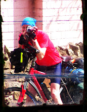
Travelling to and from start and finish:
Train to Penzance: I booked my train from Leeds to Penzance at the earliest opportunity (to the day) some three months before the trip and managed to get a £31 first-class ticket. It would only have been £19 second-class. Although it was easy to book and reserve a seat it was not possible to book a reservation for the bicycle on-line. However, a phone call was all that was required. I realised a few days later that I had no evidence of booking a place for the bicycle so I e-mailed Cross-Country trains. They e-mailed back a 'screen-dump' confirming the reservation.
Getting back from John O’Groats: As I didn’t know when I would arrive at journey’s end I could not book a return train (and therefore a cheap one) in advance. I’d heard it was not usually possible to just turn up with a bike and it would normally be necessary to book for the following day. I didn’t mind hanging round for a day, so that was no problem. I didn’t really check out train details but I knew it was possible to get a train at Wick and, indeed, Inverness.
Mapping the Route
When I started planning I didn't realise there were fairly well-established routes. I wanted to cross the Seven Bridge, go along the Great Glen and go via my home in Haworth, even though that would mean heading into the Pennines and then across the Dales. The CTC Youth Hostel route seemed to go in the right general direction and I used this as my starting point.
I messed around with road atlases and online maps and slightly modified the route but soon realised I needed something a bit more detailed. I already used Anquet on my computer for Ordnance Survey (OS) maps of my local area. I therefore decided to purchase OS maps for the whole route. I rather cleverly (at least I thought so) minimised the cost by carefully selecting small sections of map covering the entire route. Using this I planned the route using quiet routes where available, although I was not averse to busy roads where this made sense. It was possible to print the maps onto double sided A4 sheets and I was even able to modify the scale according to what details were required for the particular section (eg the long section on the A82 didn't need the same detail as the Great Glen Way, say). In order to make the maps manageable I batched them into sections (the idea was to have one section to hand and the rest in the panniers). I had no idea how far I would travel each day so the batch distances were fairly arbitrary. Ordnance Survey maps, from past experience, are not much good in towns so I printed online town maps onto the relevant OS Sheets. With Anquet it is possible to print off the profile of the route, too. I printed a profile of each batch so I knew what to expect each day.
I had a chance to test the system when I did my mini Travelodge tour in March 2009 to kick start my training. One drawback was that any deviation could quickly take you off the edge of the map. This could be just going the wrong way or deliberately deciding to go a different way as I often do when touring. I decided to tear pages out of a Road Atlas to cover the entire route as a backup.
Campsites
The OS maps indicate campsites (as did the Road Atlas, albeit not so many as the OS maps). I used various websites to check key ones were still operating and accepted tents.
This all took a fair bit of time but it at least familiarised me with the route. Most of this planning took place several months before I set off. However, I did spend a lot of time online and occasionally saw something to make me modify the route. In particular, a "least hilly" route through Cornwall and Devon was posted on the CTC Forum and I used this to modify my route. For some reason I felt it important to get some miles behind me at the beginning. This necessitated me buying more sections of OS map.
As I would be stopping off at home I only needed to take maps for the first half when I set off for Lands End.
How far would I go each day?
I wasn’t really sure but thought I’d probably manage 80Km without too much of a problem but 100Km was what I should aim at. The estimated distance of my planned route was just under 1500 km, so I reckoned it would take me 15 to 19 days. To be on the safe side and make sure no one expected me back too soon, out loud I said about 21 days.

No comments:
Post a Comment